
Low Altitude Air Photography and Photogrammetry
This is more than just a low cost alternative to traditional aerial photography or satellite imagery. Low Altitude Air Photography produces high resolution images which often have greater resolution and detail than other methods. Images can be used to create a base map or efficiently delineate or enumerate landscape or stream features such as riparian corridors, stream habitat units or land cover types. They provide a permanent two dimensional record of the current condition of the environment and a time series of multiple images can be used to compare temporal changes across weeks, seasons or years. Photogrammetry can be employed to create a permanent three dimensional record of the landscape topography, riparian zone or terrestrial vegetation. With this technique, a series of air photos is taken from a ballon, kite, or other device. Ground control points are distributed throughout the area being photographed and their location recorded with high accuracy GPS units. These control points are then used to align the photographs and correct camera angle associated distortions. Through the use of photogrammetry software we can create spatially corrected three dimensional maps which are similar to DEM or LIDAR data sets. Both the two dimensional and three dimensional products can be integrated with other GIS layers and spatial analysis techniques.
Half Duplex RFID PIT Tags and Antennas
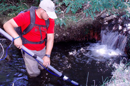 AOI has over ten years of experience in the use of half duplex Passive Integrated Transponder (PIT) tags and the design and use of half duplex antennas. This cost-effective system can be used to determined survival, growth, habitat use and movement patterns for a variety of terrestrial and aquatic species while minimizing the stress to the animal associated with multiple recaptures. We have effectively used half duplex antennas in a range of systems including large off channel ponds along the Willamette River, beaver dam complexes, and small streams in eastern Oregon.
Fish are captured using a number of techniques including electrofishing, e-herding, snorkeling, seining, trapping or angling and then implanted with PIT tags. Each tag contains a unique code which can be read by an antenna and stored in a computer along with when the detection occurred. Antennas are designed in a range of configurations from compact, mobile backpack units to large channel spanning multi antenna arrays and have a significantly greater read range than traditional full duplex tags. Mobile antennas are useful for relocating individuals at the habitat unit or reach level. Fixed stations are useful for tracking movement and migration in larger rivers, are economical to operate, require minimal maintenance and can be powered by solar panels, micro-hydro power or AC/DC power sources. The direction of fish movement can be determined by installing multiple antennas at a location, which is particularly useful in fish passage studies.
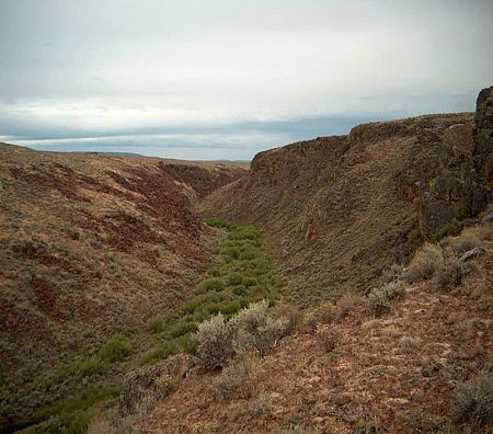
Side Imaging Sonar Stream Habitat Mapping
 Side imaging sonar is an incredibly effective tool for collecting spatially continuous data on underwater features in streams and lakes. Data from these units can be used to create a geo referenced side image mosaic which contains contiguous bank to bank information on the substrate and bottom features. These mosaic images can be used to count pieces of submerged large wood, determine the areal coverage and type of substrate (boulders, cobble, gravel, sand or bedrock), and the location and relative abundance of larger fish. Down image sonar data can be used to construct bottom contour maps, bottom hardness maps and longitudinal thalweg profiles. Contiguous data of this type is extremely labor intensive to collect using visual observations in systems with high visibility and nearly impossible to collect in systems with low visibility. This technique has a range of applications including:
- Monitoring changes in stream sediment, channel morphology or large wood recruitment over time
- Substrate mapping
- Quantify large wood
- Channel roughness calculations
- Determining fish habitat relationships
- Quantifying fish habitat
- Estimates of habitat volume
- Land use effects on stream habitat
- Effect of channel shape and substrate on hyporheic exchange